
Atlas Editions available: 1884, 1890, 1893, 1899, 1903, 1910, 1913, 1924.
Bonus Updates: 1880 Insurance Plan of the City of Toronto, 1889 Insurance Plan, The Great Toronto Fires of 1904 — and 1895
More Maps: Check out Historical Maps of Toronto — includes the 1858 WS Boulton Atlas and the 1842 Cane Topological Map of the City and Liberties of Toronto
See also: Toronto Historical Map Viewer; A Primer on Goad’s Atlases
Support the site: Buy me a coffee
About this Project: Background
Image hosting provided via the generous support of the University of Toronto Map & Data Library.
 |
| The 1910 edition came in three volumes, expanding to cover much more of the suburbs than previous editions |
This was the third major edition of Goad’s Atlas of the City of Toronto, and was rather more expansive than previous years -- in keeping with Toronto’s rapid growth. There are roughly double the number of plates!
Images courtesy of the Toronto Public Library.
Click anywhere on the index maps to view the corresponding detail plate
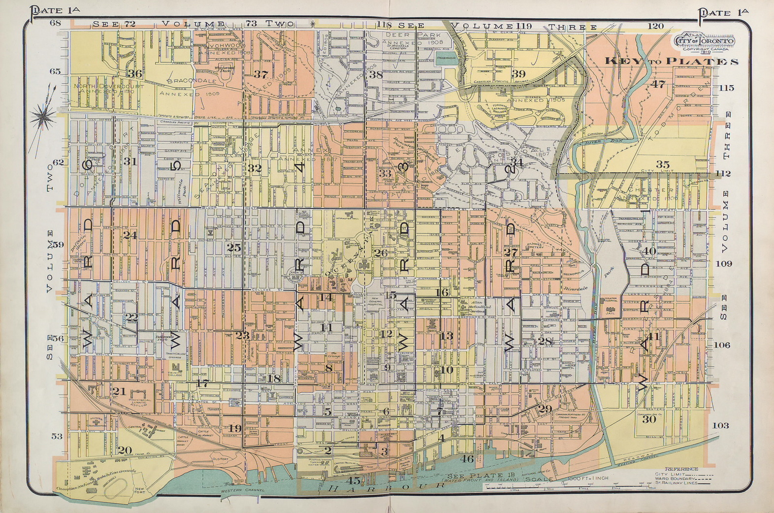
Toronto -- Volume 1 Plate 1A
“Central District: Dufferin Street, Pape Avenue, North to St. Clair Avenue.”
Toronto -- Volume 1 Plate 1B
“Water Front and Island.”

Toronto -- Volume 2 Plate 51
“West of Dufferin Street, South of Annette Street.”

Toronto -- Volume 2 Plate 52
“West of Huron Street, North of Annette Street.”

Toronto -- Volume 3 Plate 101
“East of Pape Avenue, South of St. Clair Avenue.”

Toronto -- Volume 3 Plate 102
“East of Huron and Bathurst Streets, North of St. Clair Avenue.”

Atlas Title Pages, Description, and Street Index
Click any image to expand...
 |
| Title Page, 1910 Goad’s Atlas of the City of Toronto, Volume One |
 |
| General Key and Foreword |
 |
| General Table of Contents and Vol. One Index to Registered Plans |
 |
| Index to Registered Plans Cont’d |
 |
| Atlas of the City of Toronto Street Index, Volume 1 |
 |
| Title Page, 1910 Goad’s Atlas of the City of Toronto, Volume Two |
 |
| General Key, Index to Registered Plans (Volume Two) |
 |
| Index to Registered Plans Cont’d; Street Index (Volume Two) |
 |
| Street Index Cont’d, Volume Two |
 |
| Title Page, 1910 Goad’s Atlas of the City of Toronto, Volume Three |
 |
| General Key, Index to Registered Plans (Volume Three) |
 |
| Street Index, Volume Three |
And yes, I know 1910 is not in the Victorian era.
To find out more about these maps, read: Goad’s Atlas of Toronto: Online!
Please ‘Like’ and share these maps! I hope that other Toronto heritage enthusiasts will find them useful. Have fun exploring Victorian Toronto!