
Atlas Editions available: 1884, 1890, 1893, 1899, 1903, 1910, 1913, 1924.
Bonus Updates: 1880 Insurance Plan of the City of Toronto, 1889 Insurance Plan, The Great Toronto Fires of 1904 — and 1895
More Maps: Check out Historical Maps of Toronto — includes the 1858 WS Boulton Atlas and the 1842 Cane Topological Map of the City and Liberties of Toronto
See also: Toronto Historical Map Viewer; A Primer on Goad’s Atlases
Support the site: Buy me a coffee
About this Project: Background
Image hosting provided via the generous support of the University of Toronto Map & Data Library.
Images courtesy of Toronto Public Library.
Click anywhere on the index maps to view the corresponding detail plate
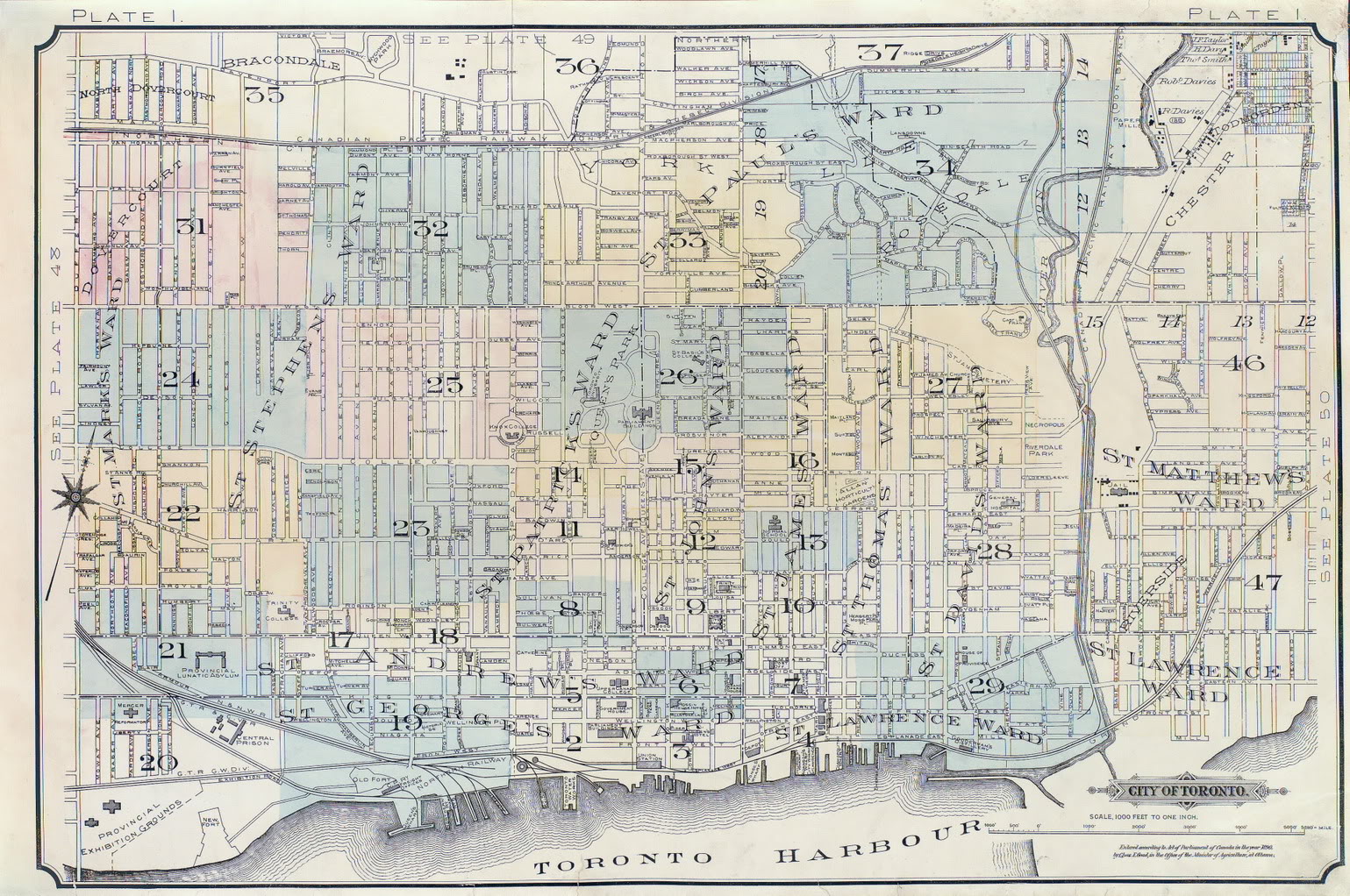
Toronto -- Central District
“Old City between Dufferin Street and Don, and North to C.P.R. Track”
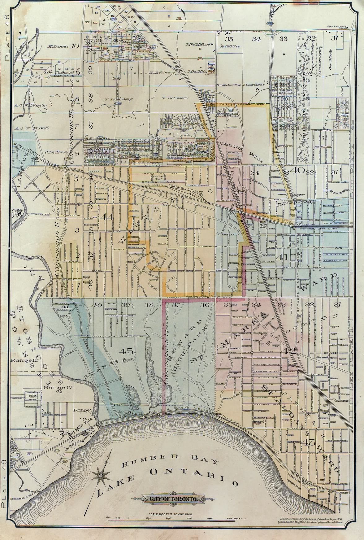
Toronto -- Western District
“Parkdale (St. Alban’s), Brockton (St. Mark’s), West Toronto, Swansea, Etc.”
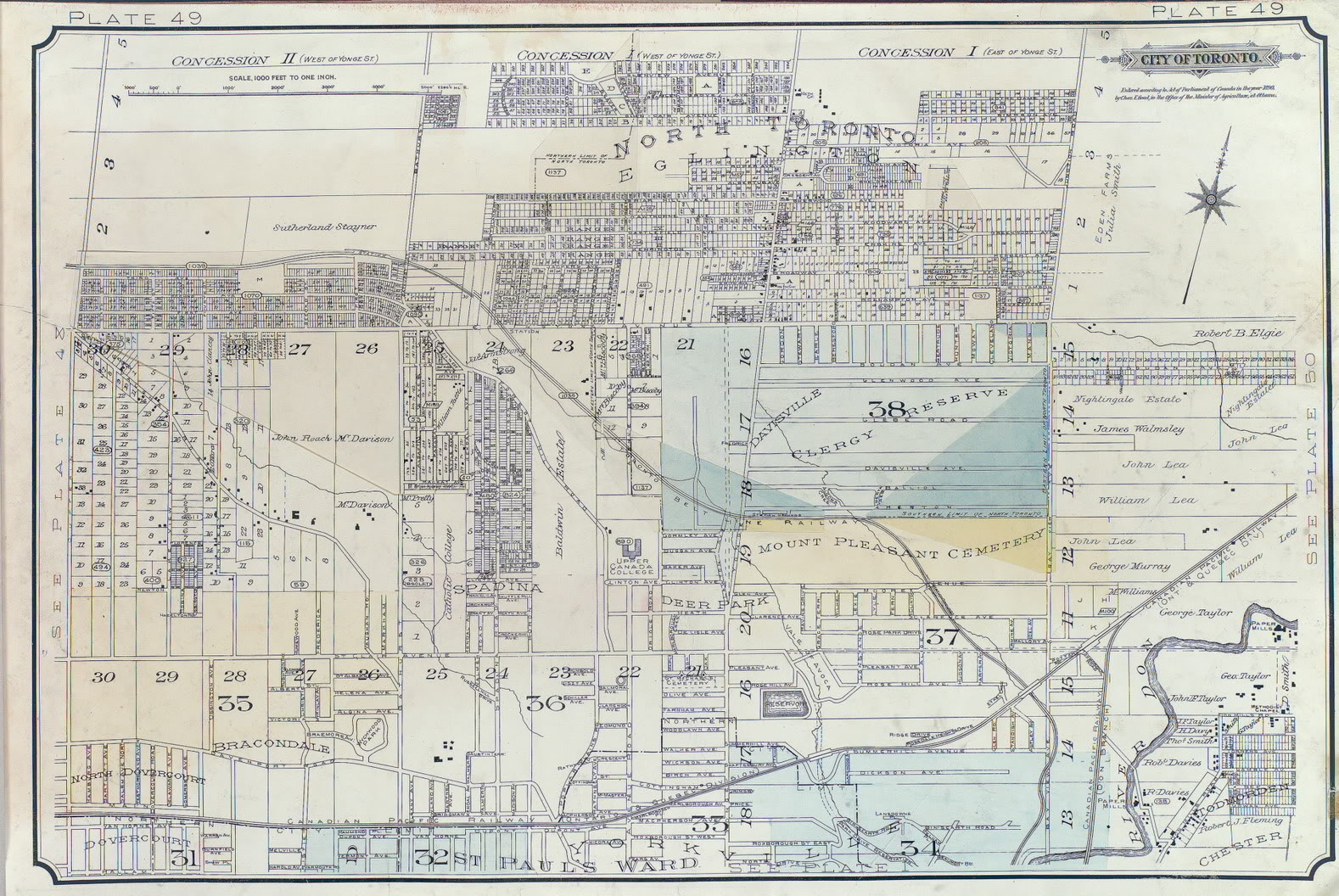
Toronto -- Northern District
“N. of C.P.R. Track, Deer Park, Davisville, Eglington (sic), Bracondale, Etc.”
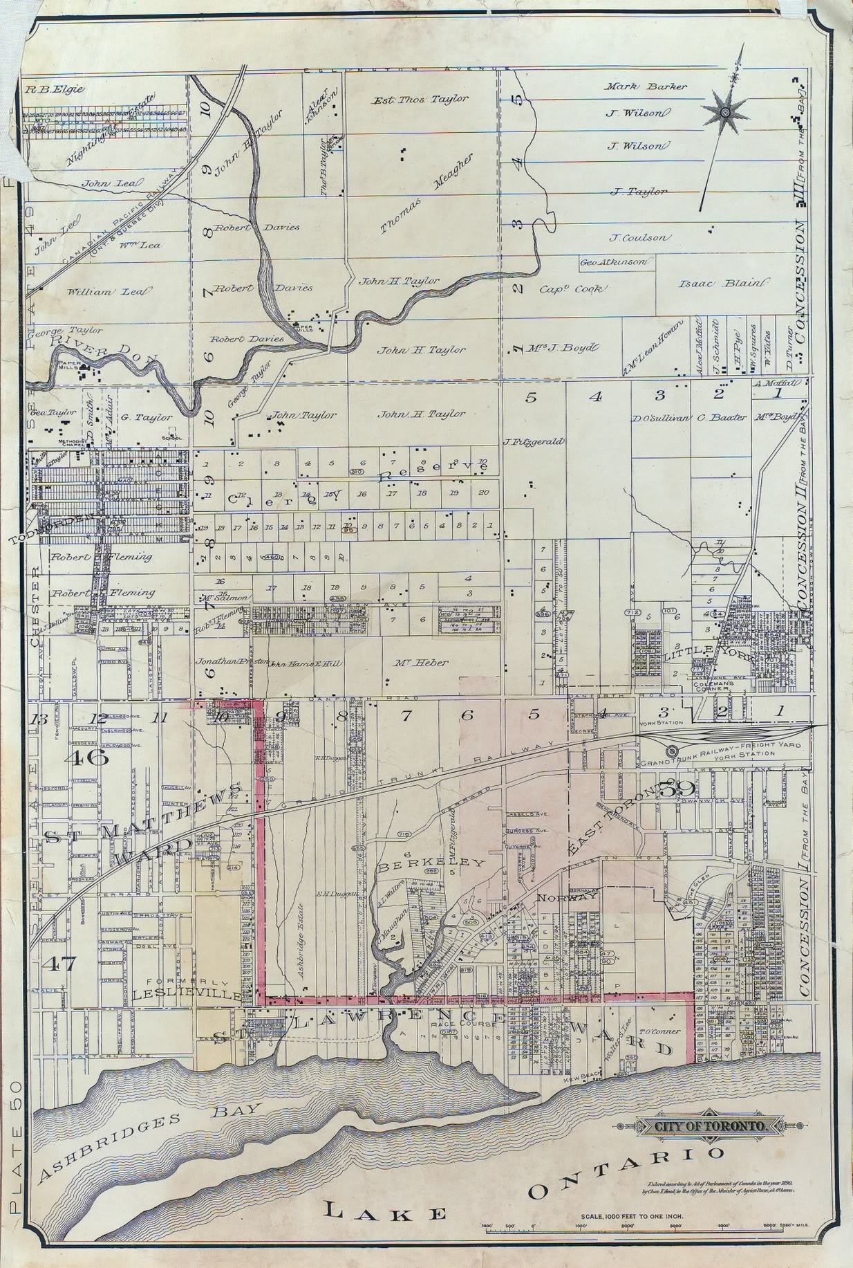
Toronto -- Eastern District
“Riverside (St. Matthew’s), Chester, East Toronto, Norway, Etc.”
Atlas Title Page, Description, and Street Index
Click the images to expand...
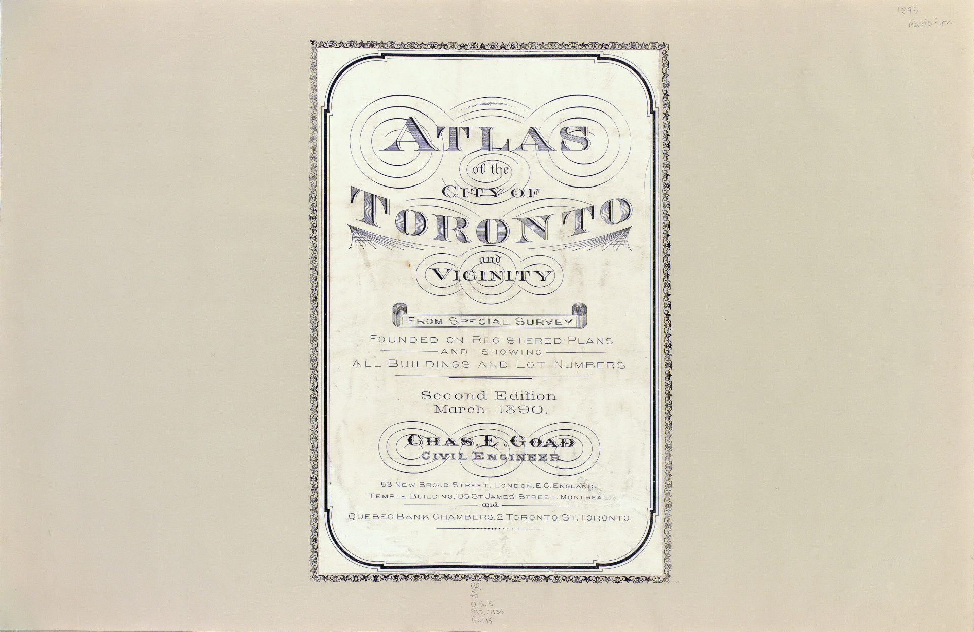 |
| 1893 Goads Atlas of the City of Toronto Title Page |
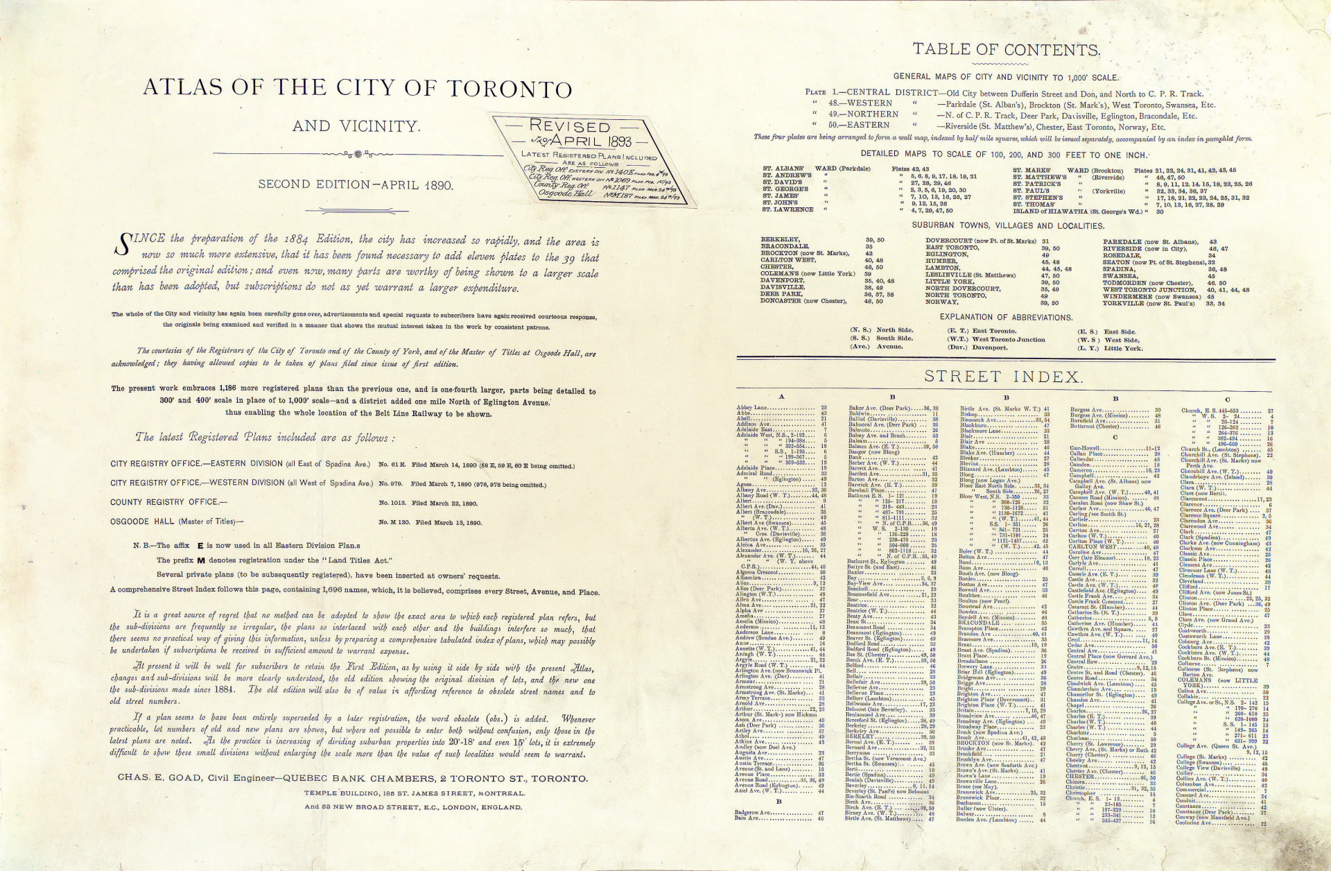 |
| Prefatory remarks, Table of Contents and Street Index |
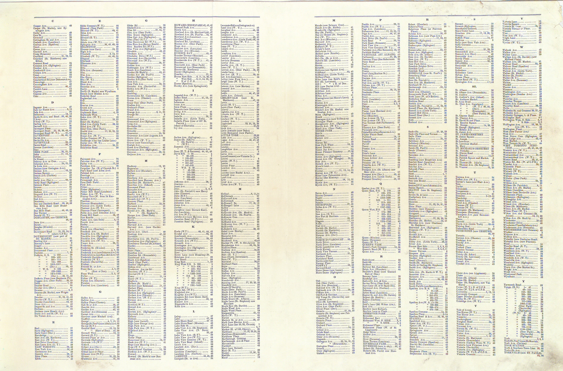 |
| Street Index Cont’d |
 |
| Cover |
To find out more about these maps, read: Goad’s Atlas of Toronto: Online!
Please ‘Like’ and share these maps! I hope that other Toronto heritage enthusiasts will find them useful. Have fun exploring Victorian Toronto!